
Buckle up, south Florida, active weather is on the way. Conditions are coming together that will be responsible for increasing winds and rain. It may also lead to flooding concerns in the coming days.
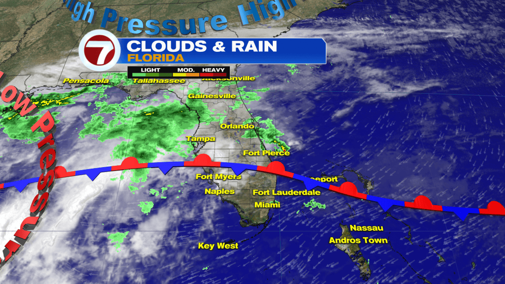
There are a number of weather features closing in on the region. It includes a stalled frontal boundary and advancing moisture. Also, a sprawling High Pressure area is situated well north of the state (getting winds cranking) while a Low Pressure system lurks over the western and central Gulf waters.
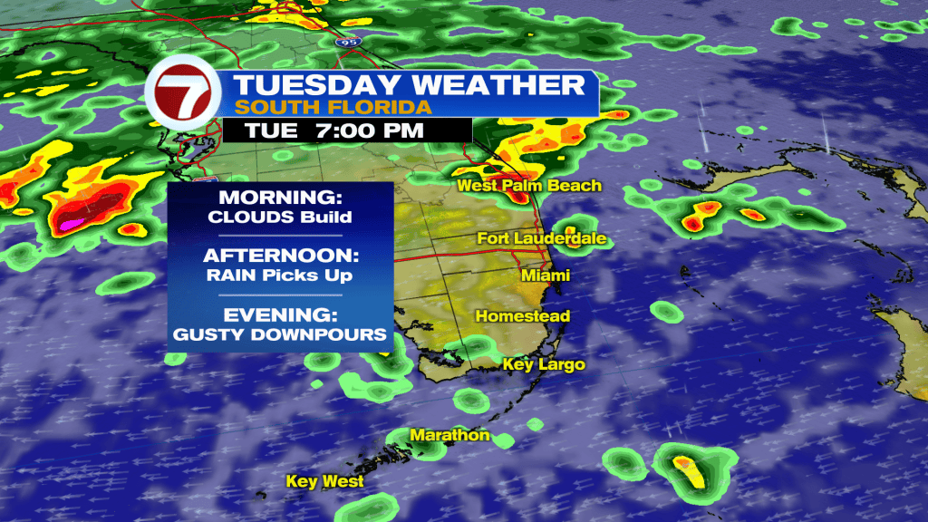
It’s going to take awhile for conditions to settle down. As a matter of fact, activity actually ramps during the midweek. As shown above, Tuesday involves building clouds, increasing rain (especially later in the day) and winds that become intense.
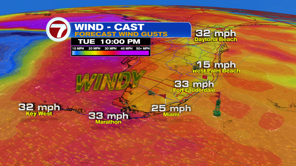
Here’s a look at future winds into late Tuesday (not the peak speeds, yet). Easily, wind gusts should exceed 30 mph at times and sources even suggest the potential of 40 mph gusts into Wednesday.
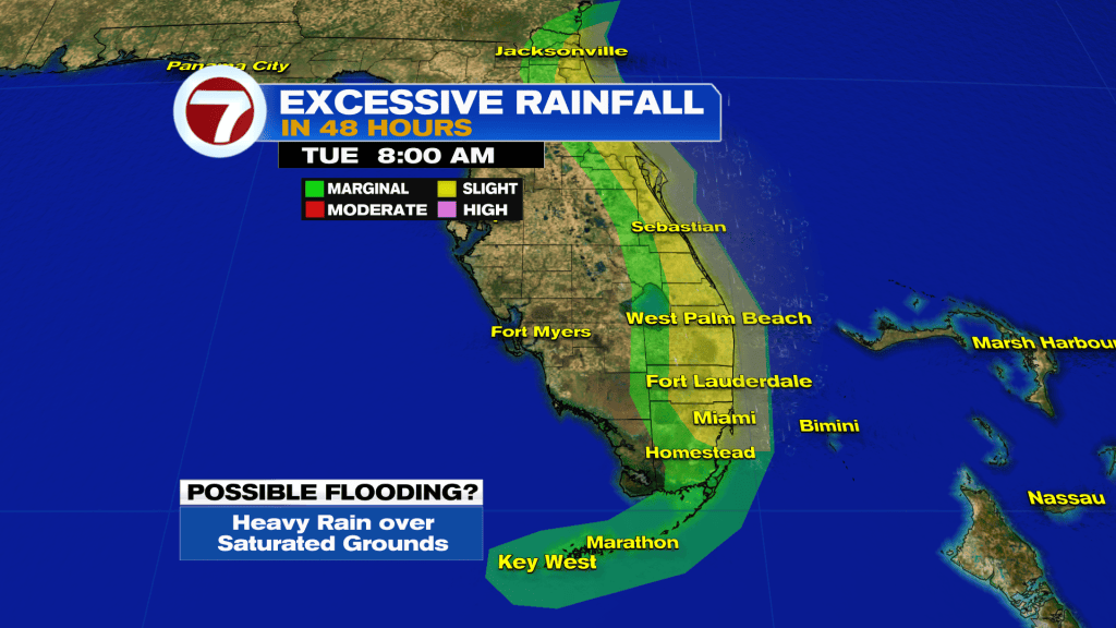
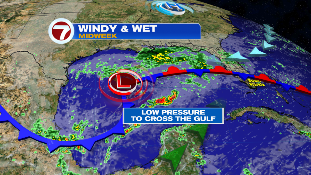
What is likely to prolong this wet and windy pattern? It’s the “slow low” that will trudge eastward. It will take time (and our patience) to get out of the grips of this messy setup.
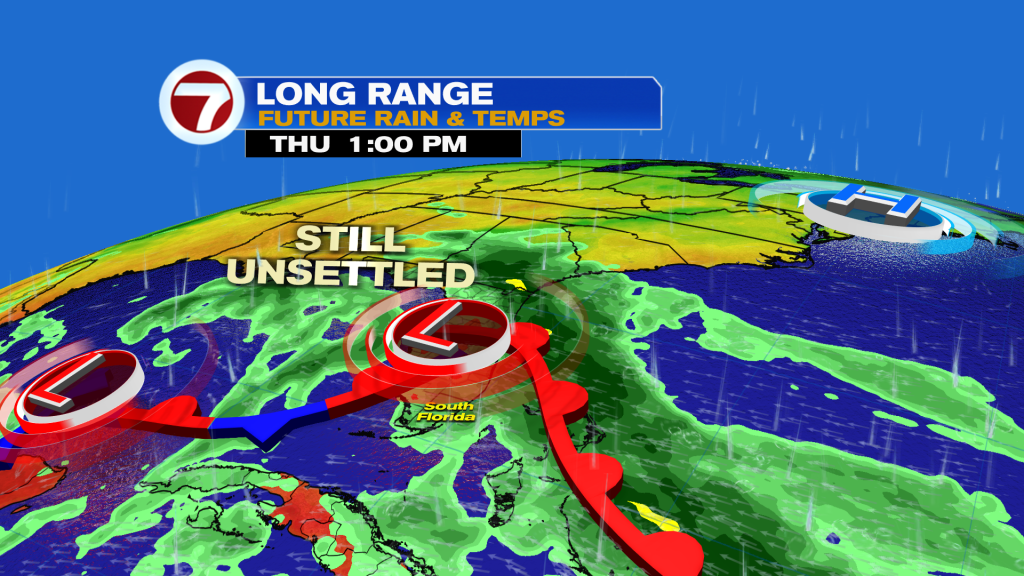
Fast forward to Thursday (shown above) and you can see the Low Pressure area sitting directly over the state. The deeper moisture (darker green) will likely have pushed farther east, and offshore. However, we won’t be “done” yet. We’ll wait for the departing initial low, then keep tabs on a trailing low, too! It will have formed south (near the Yucatan) and could still cause lingering rain over the region until the weekend, at least.


